


From towns to places, landscapes marked by settlements and human activities part 2
The toponyms, or place names, are one of the revelations of the history of the Cognac appellation since Gallo-Roman times. They give an account of the humanization of the environment and its consequences on the landscape.
© Michel Guillard
The influence of religion is reflected in the toponymy throughout the Middle Ages, as can be seen in the numerous names of monasteries, oratories, and religious figures, but above all, from the 11th to the 13th century, the extension of the word “saint”. Saint-Preuil (Sanctus Praejectus, Middle Ages) comes from Praejectus, bishop of Auvergne in the 7th century, Saint-Même (Sanctus Maximus, Middle Ages) from Maxime, name of several saints between the 4th and 7th centuries, Saint-Fort-sur-le-Né (Sanctus Fortmatus, Sanctus Fortunatus in 1110), from Fortis, bishop of Bordeaux around the 1st century, Saint-Brice (Sanctus Brictius prope Compiniacum), from Brice, bishop of Tours in the 5th century, successor of Saint Martin. La Magdeleine (fusion of Criteuil and La Magdeleine in 1860) takes its name from a chapel dedicated to Saint Madeleine, whose cult developed in the 12th century.
The Cognac region, a land of pilgrimage and crossed by the road to Santiago de Compostela, knows many of them. Saint-Ciers-du-Taillon perpetuates the memory of Saint Cyr, martyr of Cilicia in 305; Saint-Just is said to have taken his name from an ancient evangelizer of Saintonge and Poitou, originally from Limousin, and companion of Saint Hilaire, bishop of Poitiers in the 4th century; Saint-Genis-de-Saintonge owes its name to Sanctus Genesius, archbishop of Lyon in the 7th century. The village, which originates from the presence of a secondary priory of the one of Saint-Eutrope de Saintes, was then located not far from the old Roman road leading from Pons to Blaye and, later, along the very frequented road leading to Saint-Jacques-de-Compostelle. Saint-Romain-de-Benet combines the deformation of the Latin word benedictus (“blessed”) with the name of the eponymous saint, perhaps Romain de Blaye, a Gallo-Roman priest ordained by St. Martin of Tours and sent to evangelize the region of Blaye near Bordeaux, where he died; Saint-Palais (originally Saint-Pallais-de-Bren) is named after St. Pallais (Sanctus Palladius), Bishop of Saintes in the 6th century.
In the Borderies, Saint-André was first the name of a single commune, created from the parish of the same name in 1793 and which was united with that of Louzac on January 1, 1972. It is attested under the ancient form Beatus Andreas de Cumbis or de Aquis, Saint-André-des-Combes. One of the twelve apostles, particularly celebrated by the Orthodox and Catholic Churches, Saint André, gave his name to this parish as well as to many towns and villages in France and abroad. Saint-Laurent-de-Cognac, the current name of the commune since 1956, was called simply Saint-Laurent since 1790. But it had an old form in the Middle Ages: Sanctus Laurentius de Combis in Agernaco (Saint-Laurent-des-Combes de Jarnac). It takes its name from Laurent of Rome (Laurentius), an archdeacon martyred in Rome in 259. Because he was generous with his alms, he became the patron saint of the poor and his cult spread throughout France. The oldest form of the name of Saint Sulpice de Cognac is Sanctus Sulpitius prope Compiniacum (Saint Sulpice near Cognac). This 7th century bishop of Bourges was particularly honored for his miracles and his life of poverty, so that many parishes adopted him as their patron saint. It should be noted that during the Revolution, the name of the commune was changed to Sulpice Antenne.
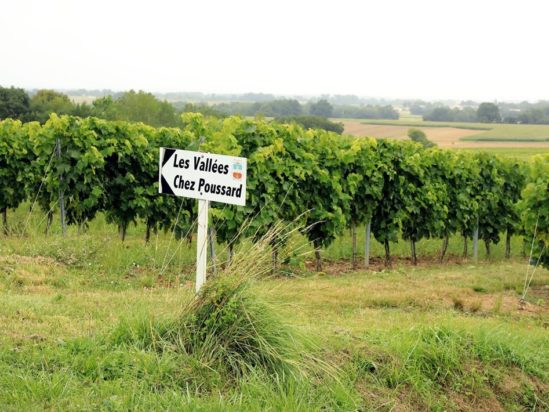
Other procedures, this time syntactic, consist in following the domain with the name of the owner in a roman and French order: Le Maine Garnier, Le Maine Allain, Le Maine Laurent, Le Petit Maine Garnier. In more recent times, the place is expressed by “chez” (lat. pop. in casa “in the house”), the French equivalent of the Latin -acum, in a very large number of place-names like Chez Guillon, Chez Grelet, Chez Gombaud, Chez Gimbert, Chez Gatineau, Chez Ferchaud, Chez Bureau, Chez Brunet, Chez Branger, Chez Bourlon…
If the toponyms give part of the history of the settlements, they also contribute to underline the outstanding features of the landscapes, from geology to relief, from climate to vegetation. Geological and geographical aspects appear clearly in La Groie, La Grouasse, Cravans (from a prelatin *grava “sand, gravel”), Le Chail, Chaillevette whose root chail designates a stone and, by extension, a very calcareous land, Le Pérou, La Perruge (“stony places”, borrowed from Greek by Latin petra, with absence of diphthong and Saintongean suffixes).
The streams, rivers and brooks are numerous to specify the name of communes or hamlets: the Charente, whose original name is discussed, would be the sandy (pre-Celtic *caranto “sand”, with the suffixe-ona), the Seudre, the Né, the Boutonne, the Touvre, the Sougne, the Lidon, streams that surround with notoriety many appellations (Angeac-Charente, Brive-sur-Charente, Bourg-sur-Charente, Tonnay-Charente, Mornac-sur-Seudre, Nieulle-sur-Seudre, Tonnay-Boutonne, Saint-Fort-sur-le-Né, Lagardesur-le-Né, Saint-Palais-du-Né, Magnac-sur-Touvre, Fléac-sur-Sougne, Saint-André-de-Lidon… ). Often they give way to streams, or reefs, and the place is then called Le ri Bellot (Borderies), Port de Ri (Talmont).
Fountains are celebrated everywhere as sources of life: Fontdouce, Fontcouverte, Fontsèche, Fontchabrère, Fontaine-Chalandray, La Font Rivaud, Fontrouille… Also the places can become humid and the paradise of snails, mentioned in many places like Le Cagouillac (Chérac), Le Cagouillet (Cognac), Les Cagouilles (Pérignac), La Cagouillère (Saint-Savinien), and constitute “mothes” for the cultivation of vegetables, also named Les Mathes, or lands “where walking makes the water go up in the shoes”, as it is properly the meaning of the toponym Mongaugé. The Doue (lat. doga, “vase”, which has taken on the meaning of ditch or stave) can then be present, giving its name to Douhet. Sometimes even a ford, noted in the word Le Gua (lat. vadum, which became *gwadu with a francique guttural found in words of the same origin such as wasp, for example), makes it possible to cross the Palue (lat. palludium “swamp”), found in Gensac-la-Pallue or Palluaud. Bridges are indicated to cross waterways, as is reminded in particular by the town of Pons situated on the Seugne (Low Latin pontes, plural of the Latin pons “bridges”), Gond Pontouvre (contraction of “bridge over the Touvre”), Annepont which indeed refers to a bridge.
The landscape drawn by the toponyms follows the low relief of the soils, marked especially by the hillsides, the mounts, the puys and the combes. Thus Saint-Georges-des- Coteaux, Le Grand-Coteau, Le Coteau-des-Bergers, Le Coteau-des-Charlons, Le Coteau, Puymoyen (lat. podium medianum ” summit of the middle “), Aigneset-Puyperoux, separating combes or valleys that one sees appearing, for example, in Saint-Laurent-des-Combes, Vaux-Lavalette, Vaux-Rouillac, Port d’Envaux. Sometimes promontories appear, as in the toponym Merpins (Merpens around 1081), which is generally traced back to the Gallic *maropennos, “big promontory”, from the words maro-, “big”, and penno-, “head”, which seems to refer to the situation of the locality built on an advanced hill which dominates the Charente.
The perchaud, a word from the medieval period, metaphorically designates a hillock. It is thus a stony hill in Le Perchaud-du-Chail. Words like Crazannes (Celtic crazenn “height, hill, mound”), Talmont (from Gallic talo “front” and Latin montem “mound”, or from the Gallic compound *talamon, < Celtic *talamu(n) “front, surface”) similarly indicate a slope, a height. Brie-sous-Chalais, Briesur-Mortagne (from Gallic briga “height”), Montendre, Montlieu, Monguyon, Montpellier, Montils (lat. montem, “summit”) have the same meaning, as well as Montpellier-de-Médillan, from Latin mons petrosus which became in Old French monpeirié (“stone hill”) indicating a small height in a landscape of plains, belonging to a certain Metellus.
Next to this, there may be plains reserved for grazing (La Prée, Saint-Laurent-de-la-Prée) or for cultivation, specified by numerous toponyms, probably at the origin of the first two crus of Cognac (Grande and Petite Champagne), such as Champagnac, Jarnac-Champagne, Saint-Ciers-Champagne, Champagne de Blanzac, Champagnolles, Angeac-Champagne (with a feminine suffix, from lat. campanea “country of plain”). Maritime lands to the west are indicated by toponyms such as Marennes (Terra Maritimensis which designates the ancient peninsula which extended in Roman times from Chapus to Le Gua, enclosed between the gulfs of Brouage and Seudre), L’Éguille (from lat. acus “point, needle”, which became acus and agulhe in the texts of the Middle Ages, then needle) which designates the point of Cretaceous limestone on which the municipality is located. These areas are often covered with woods (from the Lower Latin boscus which indicates a place with trees), as can be seen in Saint-Bris-des-Bois, Bois-Redon, Bois, Saint-Hilaire-du-Bois, Saint-Dizant-du-Bois, Villars-les-Bois, Bois-de-Montmoreau, Bois-Breteau, Bois-de-Baignes, and are undoubtedly at the origin, depending on their size, of the names of the Cognac vintages Bois ordinaires, Bons Bois, Fins Bois, names that also refer, in this case, to the wood of the vine. We can also see the vegetation elements that are characteristic of the area. Thus Arvert, which can be traced back to the Gallic root verno, alive in the south of France in the form verne, vern, ver or vert to designate the alder (the only form used in the north), refers to a place planted with alders. Toponyms such as Les Brousses (from pop. lat. *bruscia “brush”), Les Brandes (der. of brander “to blaze”, from germ. *brand “firebrand”) evoke rather places where the vegetation is wild. Next to it stand out Le Pin (lat. pinus “pine”), Le Boulas (lat. pop. betullus, from lat. betulla “birch”), Les Nauds, Les Nouillers (lat. nux “walnut, walnut trees”) which indicate places frequented throughout the land where trees served as landmarks. L’Houmade, a place planted with elm trees (umia in Saintongeais, from lat. ulmus), Les Fresneaux (a humid place where fresnes grow), La Châgnée, a Saintongeais name for a plantation of oak trees… CormeÉcluse or Corme-Royal indicate places planted with corm trees. La Tremblade probably owes its name to the presence, in the Middle Ages, of aspen trees in the forests of the region. Les Fougères, La Pommeraie, Le Roseau add their note to the name.
But these spaces are not only natural sceneries, they are used for the cultures and the activities of the inhabitants. It was first necessary to conquer them, to clear them, to cultivate them. The forest, a common name in the French regions, indeed testifies to transformations in the exploitation of the soil. The adjective forasticus “outside”, from the Latin foris “outside of”, which can be found in the Italian forastico, the Sicilian furestico, the Provençal foresque, served as the basis for the formation of forestare “to put out, banish”. Foresta originally meant “ban, proscription” and designated a piece of land on which a ban was pronounced, a proscription of cultivation, of habitation, in the interest of the lordly hunt. From there forestare meant to create a forest, because these prohibitions applied especially to the woods where wild animals were found and that, moreover, trees soon grew in the countryside thus withdrawn from cultivation. It is this transition historically noted between foresta, prohibited territory, and forest, to which the toponym present everywhere in the region testifies.
But the seam that designated the lands of the city or the seigneurial domain in the Middle Ages did not pose any problem: they were cultivated directly by the seigneur or his stewards. In any case, medieval land clearing imposed essarts, i.e., spaded and weeded land, everywhere. The word comes from the late Latin exsartum, attested in the Burgundian law, derived from the Latin *exsarire, from the classical Latin sarire “to weed”. It also results from Breuillets (diminutive of Breux and derived from the Gallic word brogilos, from broca “field”), a word found in Welsh and Breton. In Low Latin brogilus took the meaning of “small fenced wood” or “clearing for cultivation or breeding”, then that of “wet wood dotted with ponds”. Les Grandes Versennes, a very common locality (derived from verser, from the Latin versare, which took on the meaning of “to turn, to turn over” in the Middle Ages), designated in old French a “land that rests after having given two harvests” or “a land prepared for sowing”. Depending on the location of the land, it can be a set of contiguous ploughed fields whose furrows have the same direction or a furrow or the length of a furrow.
Some places indicate more precisely the nature of an agricultural activity. Le Vanneau (from van, lat. vannus, XIIIth c.), Le Bluteau (from blutter, XIIIth c., borrowed from the Middle High German bluteln “blutter”) and Le Moulin, sometimes called Virollet, which is very common in the localities of the windy plains of Aunis and Saintonge, suggest an activity related to cereals. Hemp was also part of the crops grown in places watered by rivers. The toponym Cherves (in the latinized form of Charvis) represents the Saintongean variant charve of the word chanvre. Indeed, one of the main occupations was the cultivation and retting of hemp. The “hemp stones” along the Antenne river and in the wash houses are the last witnesses of this.
Flax was also present, as shown by the toponym Lignières, from the Gallo-Roman linariu, linarias “land where flax is grown”. The vine also appears in toponyms such as Vignolles (Petite Champagne), places like Le Treuil (lat. torculum “press”) which indicates a place where there was a seigneurial or communal press, La Piponnerie which designates a place of casks, Bourrut or Bourru (adj. and n. m. 1555), which refers to the bourru or bourrette wine, a new wine, coming out of the vat or the press, still charged with carbonic gas and whose transparency is obscured by a large quantity of lees, hence its name.
More rarely, it is the subsoil resources that seem to be exploited. Thus Ferry evokes a metallurgical site from the Second Iron Age and Champblanc saw, before their exploitation, outcrops of saccharoid gypsum, very white. The names of the places called Fontaulière (formerly Font Houillères) and Charbonnière seem to attest the presence of coal in Borderies. But it is the stone of Saintonge, transported to Cologne for the construction of its cathedral, which constitutes the most famous wealth of the subsoil.
Thénac has the blue stone quarries of Les Mauds, those of Fief-de la-Clochetterie exploited since the Antiquity. These are underground quarries of several hectares dug in a hard limestone of white color. Four banks of stone were exploited there, three are still exploited; the site applies to be part of the Industrial Heritage. Saint-Même-les-Carrières bears witness, if only by its name, to this activity. If the last stone quarry closed in 1977, there are still two stone cutters and sand pits exploited for sand and gravel. Lime kilns, tile factories and pottery workshops were also numerous a good century ago. We can see traces of them in the places called Le Four à Chaux (Ré), Les Tuileries, La Chapelle des Pots, Les Bujoliers (in Saint Césaire where bujours, large earthen vats for washing clothes, were made). Livestock breeding and dairies spread after the phylloxera crisis, especially in Aunis and the north of the Charente-Maritime department, without the toponymy bearing many traces. However, there are places like Les Vacherons, La Crèche… The salt marshes of the island of Ré were used for salt extraction before the oyster farmers converted them into oyster ponds. The Port des Salines (Ré) bears witness to this. These activities gave rise to exchanges and the toponymy bears traces of relays and trading posts. The Magasin could correspond to a gabarier port as it existed along the Charente well before the Roman presence, and until the 19th century for the transport of goods. Derived from the Latin stabula (“stable, inn, post house”), the word Étaulles marks a gathering point for trade but also for religious gatherings. Mainxe (Mansia, Mincia, Maencia in the Middle Ages; created in 1793 under the name of Mainx, it became Mainxe in 1801) is an example. Established on the edge of the Chemin Boisné, the village would have been a stopover for pilgrims on their way to Santiago de Compostela, according to a place called Le Champ Jacquet on the edge of the ancient Roman road. We also know that the hospital of Pons was a place of reunion for the pilgrims.
© Michel Guillard
With the creation of new towns, new words appear in the designation of places, such as “bourg” (Bourg-Charente) or “ville” (Éraville, Gondeville…), the habitat diversifies from “La Cabane” to “La Grand Maison”, from “L’Hermitage” to “Marquiseau” or “Les Châtelards”, “Chateauneuf”, “Chateaubernard”. The low houses of the islands in the west, adapted to the sea winds, give way in the east to the estates or maines (Le Maine Giraud, Le Maine Allain) with their stone dwellings closed by beautiful porches and sometimes including dovecotes or dovecotes and outbuildings (bungalows). Traces of ancient monuments can be seen in the localities (Le Bois du Chata, La Tour de Pirelonge), and above all, religious beliefs can be seen everywhere, recalled by the Romanesque churches and temples, the abbeys (Fontdouce), the convents and the commanderies: La Commanderie-des-Épeaux, Saint-Aulais-La-Chapelle, Saint-Simon-de-Bordes, Sablonceaux, La Templerie, which seems to evoke the templery of Cherves, also known as Saint-André, a supposed former Templar commandery of which no remains remain.
© Michel Guillard
The Revolution gave us interesting names because of their pictorial character: Chaumières-sur-mer for Saint-Palais-sur-Mer, La Réunion-du-Peuple, Romain-la-Tour, Romain-la-Fontaine for Saint-Romain-de-Benêt, Brutus for Saint-Just-Luzac… That is to say that toponymy gives a good account, sometimes in an unexpected way, of the outstanding features of the places, to the point of translating in a brutal way the heurs and misfortunes of the population. Who would believe that the Charentais could live in a place called Misère (Chérac), Toutlifaut (“where everything is missing”, Meursac), Gâte-Bourse and Gâte-Chien (Javrezac) or even Gâte-Bien (a kind of cut-throat, Nancras)? But, fortunately, there is something to rejoice about in Chantemerle (Bons Bois), Montplaisir and Paradis (Borderies), places of joy and bliss.
We can thus see that toponymy has recorded many characteristic aspects of the Cognac terroirs, which are naturally varied, from the marks of the first settlements to the geographical aspects, the activities of the inhabitants, their way of life and their beliefs. Even if this synthesis has been able to identify characteristic elements, it is far from being exhaustive. However, it shows how a natural landscape can acquire a cultural and significant value: behind the plains and the vegetation, the habits and customs, the efforts and the values of the men who make the landscapes of Cognac places to discover, to imagine and to interpret.