Combs, conches and cliffs of the right bank of the Gironde
From Royan to Saint-Thomas-de-Conac, on the right bank of the Gironde, the Bons Bois and an enclave of Fins Bois are located on the edge of a singular coastline where combes, conches and cliffs alternate.
Combe

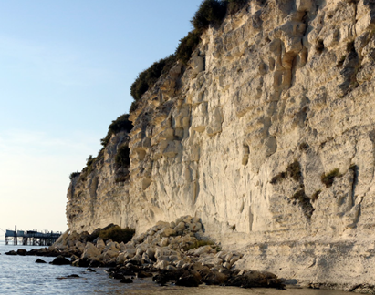
The rocky platform of the cliffs sometimes supports carrelets on pontoon, typical fishing installations of the coasts of Aunis and Saintonge.
Located on the right bank of the estuary, a combe is a geologically recent (12,000 years) remnant of a small tributary of the Gironde.
1- During the last Quaternary glaciation (Würm), the river and its tributaries dug deeply their bed.
2- During the following warming, the water level rose by melting of the ice. The Gironde invaded the lower lateral valleys, depositing large masses of alluvium.
3- This silt formed the soil of the marshes colonized by vegetation. Due to the lack of water supply, these small valleys have dried up, with some rivers sinking into the limestone. They sometimes resurface in the form of springs: the Font Garnier, Fondevine…
4- On these soils of Champagne, the man cultivates especially cereals and vine planted in top of cliff or on the side of the valleys
Conch

At the foot of the Caillaud cliff, in Talmont-sur-Gironde, the scree due to erosion and rainwater infiltration is rich in a great variety of fossils.
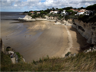
A conch is a sandy barrier beach. Its cove shape is reminiscent of the rounded edge of certain bivalve shells (Latin concha “shell”). There are two types of conches. Sometimes large, the first are originally sandy spits developed between two rocky points, isolating marshes that opened up on the edge of the estuary. Important deposits of sand have formed dunes that have been fixed by pine and holm oak. This is the case of the Grande Conche of Royan, the one of Saint-Georges-les-Didonne, and the Vergnes.
The second ones, smaller, are leaning against cliffs. They are only accessible by the sea at low tide, sometimes by stairs dug in the rock or built (conch of Saint-Sordelin, of Chay, of Nonnes). The conch of Cadet is the last sandy beach of the estuary. Further upstream, the marshes open onto the Gironde by mud flats but the word “conche” still designates them. They are numerous on the maps of the 18th century, like the conche at La Combe. Only Conchemarche near Mortagne has been preserved.
Cliff

The conch of Cadet, accessible by a staircase dug in the rock, is the last sandy beach of the Gironde estuary.
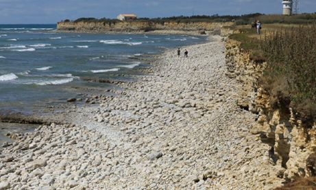
Along the ocean, the sea shapes the cliffs. At the Pointe de Chassiron (Oléron Island), the older (Jurassic) folded and then eroded grounds have taken on a variegated and aesthetic aspect. At the foot of the cliff, marine erosion has levelled a rocky foreshore on which more original fishing facilities have been built: the fish locks. The dry stone walls that limit them are horseshoe-shaped. At high tide, the sea covers them and brings the fish. Openings in the wall allow the emptying of the lock at low tide and the trapping of various species (mullet, sea bass, eel, sole…). They are fished before the “low water” with curious hand nets: the shears.
© Michel Guillard


